
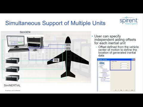
Phillip Bonilla, Systems Engineer at Spirent Federal, discusses how SimINERTIAL simulates inertial data to model specific IMU/EGI test interface
GPS has a number of inherent vulnerabilities in terms of access and integrity. The use of inertial sensors to provide an augmentation to GPS improves anti-jam robustness, positioning continuity, and enhanced precision for mission-critical military applications. An Inertial Navigation System (INS) provides position, velocity, orientation and angular velocity by measuring the linear and angular accelerations applied to the system. Spirent offers a number of systems designed to simulate the inertial sensor outputs coherently with simulated GPS RF, thus enabling the inertial receiver elements to be tested.
Integrated GPS/INS systems are essential for high dynamic platforms and provide continuous navigation during RF interference or degraded satellite signal conditions. While GPS/INS system testing may be conducted on the host platform (such as an aircraft), this approach is prohibitively expensive for extended tests and does not allow for repeatability under controlled conditions. A more cost-effective approach is to test the GPS/INS system in the lab. Modeling physical sensors using accurate error parameters in our simulation environment enables users to tune integrations and algorithms prior to deployment.
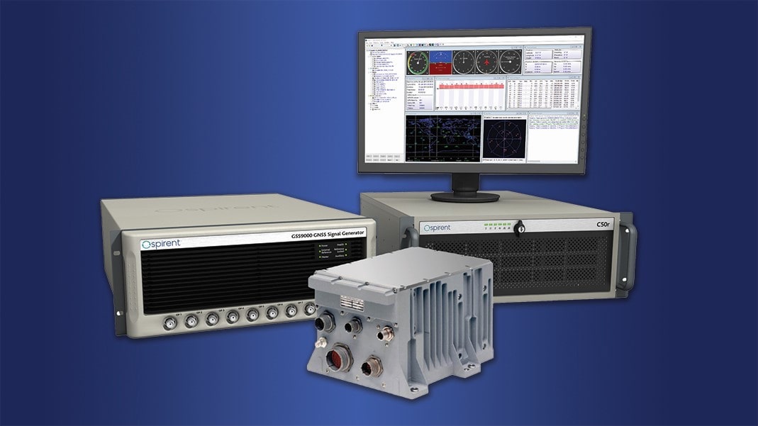
Spirent’s inertial simulation product, SimINERTIAL, enhances the capability of Spirent simulation systems by adding the capability to either simulate embedded GPS/inertial systems (EGIs), individually coupled GNSS/INS systems (IGIs), or standalone inertial measurement units (IMUs) to simulate coherent GNSS and sensor measurements to evaluate positioning algorithms. Spirent supports a variety of GPS/INS interfaces, including Northrop Grumman (Litton), Honeywell, and NATO STANAG 4572.

Transportation Requires a Fusion; Now to Test It
Inertial navigation systems (INS), like most navigation systems, have evolved through countless iterations and improvements over many years. An INS, unlike other navigation technologies, does not rely on any external signals or inputs to aid navigation. It is, therefore, extremely difficult to spoof, jam or disrupt the system, and solar flares, ground/sky visibility and climate […]
Read Blog
GPS Vulnerability Mitigation: Using Inertial & Complementary PNT
While GPS will always be an integral and irreplaceable part of PNT, Assured PNT must take a layered approach due to GNSS vulnerabilities. Join Spirent and Northrop Grumman as we examine the future of inertial navigation in Assured PNT and GPS augmentation, EGI-Modernization, coherent GNSS and inertial sensor emulation, and exploring and simulating emerging alternative […]
View Webinar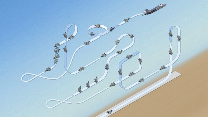
Spirent Federal Systems Teams with Northrop Grumman
Plans are underway to fully validate the inertial interface between Spirent GNSS simulators and both Northrop Grumman legacy and modernized inertial systems under the EGI‐M program.
Read Press Release